How the DJI Zenmuse L1 LiDAR Solution Lighting up the Surveying World
The surveying industry is a testament to how commercial application of drone technology has resulted in demonstrable value for stakeholders.
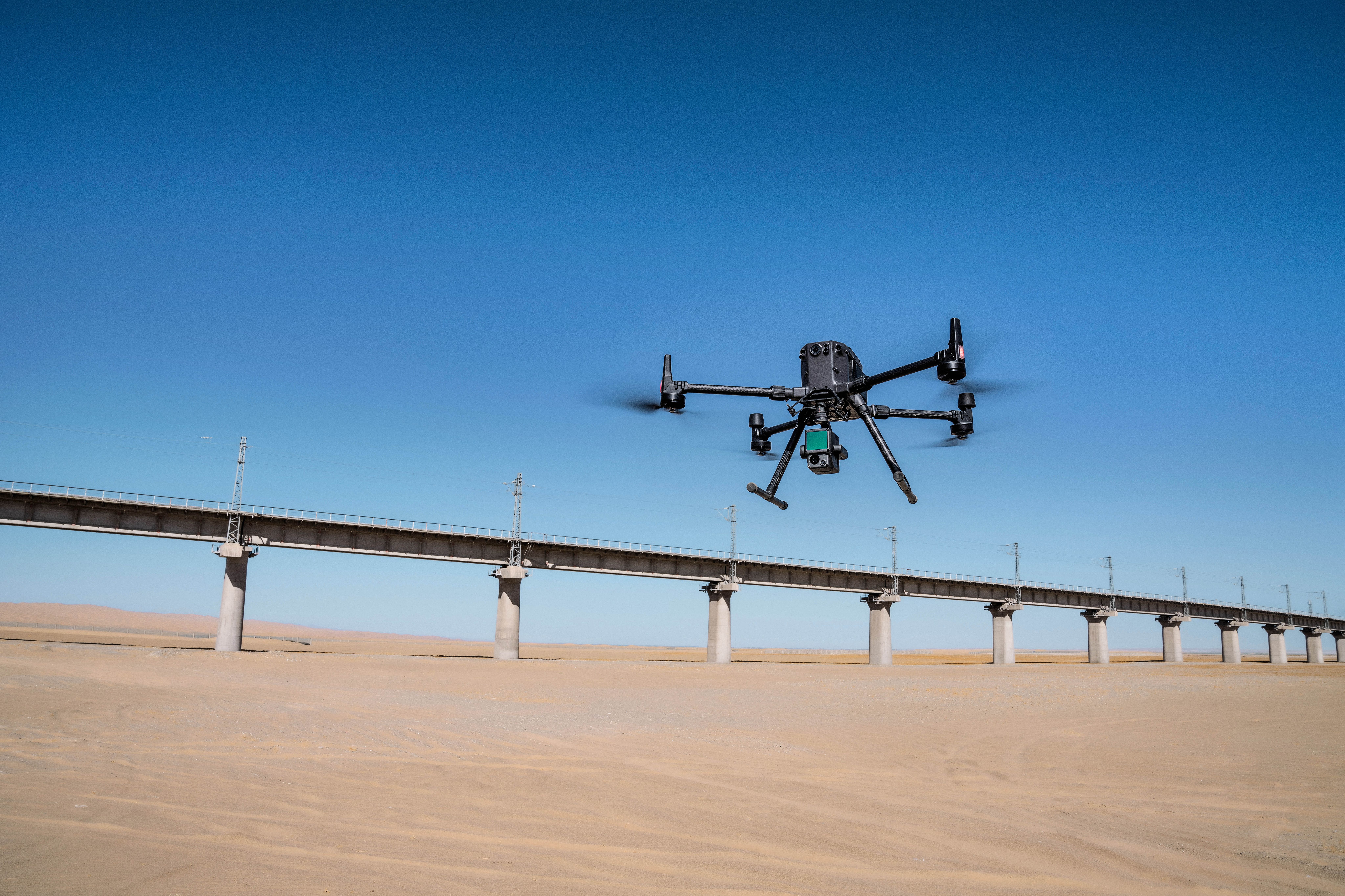
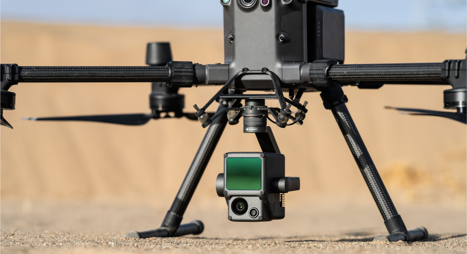
In October 2020, DJI, the global leader in civilian drones and aerial imaging technology, unveiled its first integrated LiDAR payload - the Zenmuse L1. Since its release, the L1 has revolutionized the surveying industry, bringing new perspectives, more efficiency and greater access to LiDAR data. It achieves all this without compromising the quality and accuracy of the data collected. Combined with the DJI Matrice 300 RTK drone and Terra software, the Zenmuse L1 offers a seamless and integrated system for LiDAR data collection and processing.
What is LIDAR?
Light Detection and Ranging (LiDAR) is a method that determines the distance to a target by sending pulses of light to the target and measuring the return signal. Simply put, the calculated time difference between the light pulse sent and the reflected pulse received shows the target's distance.
LiDAR-equipped drones have sensors that determine the accurate position of the target the laser light hits. As a result, it helps to design detailed visualization of what the sensor is focusing on. This is ideal for determining the elevation of the ground, forest and buildings.
LiDAR and Aerial Surveying
LiDAR technology, particularly for aerial surveying, has been of limited application in many industries due to the high cost, complexity, and difficulty of reliably integrating the system's various components. Therefore, it is not surprising that commercial adoption of LiDAR in aerial surveying has been significantly slower than photogrammetry.
DJI’s Zenmuse L1 is a game-changing LiDAR solution and aerial surveying tool, particularly for collecting data in dense vegetation where ground or terrain level data is crucial. It is also ideal for mapping power lines, infrastructure, agriculture, forestry, construction, mining, emergency response and many more. The Zenmuse L1 will make LiDAR data collection more accessible, opening new use cases of LiDAR in many industries.

Let’s take a look at the advantages and technical features of the Zenmuse L1.
Advantages of the Zenmuse L1
Overcomes vegetation challenges
The Zenmuse L1 is ideal for capturing data in densely vegetated terrain, where surveyors cannot easily walk through or gather data. It eliminates the need for moving physical stations every time. The capability of the L1 in capturing accurate data, irrespective of the dense vegetation, presents an advantage over traditional photogrammetric methods.
Captures real-time point clouds in adverse weather
L1’s active scanning system is perfect for data collection in unfavourable weather, such as fog, low light conditions or at night. Surveyors can use the LiDAR in scenarios where conventional surveying is not ideal. The situations can include the incidence of earthquakes or the need to work on projects at night.
Since DJI’s L1 LiDAR is durable and rugged, it comes in handy in many scenarios, including search and rescue efforts. The L1 sensor provides high-quality and detailed point cloud data. It streams point clouds in real-time, allowing users to create true-colour point cloud models on-site via its LiveView feature.
Automated and easy-to-use
DJI has done an excellent job designing and manufacturing an easy-to-use integrated LiDAR solution that supports surveyors undertaking aerial surveying projects. The L1 works with the Matrice 300 RTK taking advantage of the drone's powerful flight features. In a single flight, the Matrice 300 RTK and Zenmuse L1 can collect high-density point cloud data over an area of 2km2 operating at the height of 100m and speed of 10m/s. The integration helps to avoid problems that might occur if the drone operates separately from the LiDAR sensor.
Affordable price
In terms of cost, DJI's L1 is priced competitively compared to other systems that come at higher price tags. Because the DJI Zenmuse L1 camera works with Matrice 300 RTK and DJI Terra software, there’s no need to invest in third-party hardware or software. The complete integration of the module within the DJI ecosystem means a reliable and compatible system that supports LiDAR mapping.
Features of Zenmuse L1
Three Returns Per Laser Shot
The Zenmuse L1 Livox LiDAR payload delivers a point rate of 240,000/sec. And it allows up to three returns per laser shot, meaning the point rate can increase up to 480,000/sec in a project with fewer returns. The multiple return feature allows surveyors and analysts to classify various objects in a point cloud. The Zenmuse L1 has a detection range of 450m at 80% reflectivity, 0 klx; and 190 m at 10% reflectivity, 100 klx.
Integrated IMU (Inertial Measurement Unit)
A high accuracy IMU is vital for the collection of reliable LiDAR data. The IMU measures both angular velocity and real-time three-axis acceleration working out the drone’s speed, position and altitude. The L1 features an industrial-grade IMU, with the capability of delivering IMU accuracy of 0.025°(roll/pitch)/0.08°(yaw). The Zenmuse L1 can achieve survey-grade vertical accuracy of 5cm and horizontal accuracy of 10cm at a 50m flight altitude.
Non-Repetitive Scan Mode
In addition to line scan mode, the L1 supports non-repetitive scanning mode allowing the L1 to cover an extensive area within a short amount of time and collect data from any direction.
20MP 1-inch CMOS Sensor
Thanks to L1's 20MP 1-inch CMOS sensor, surveyors can capture images, record videos, and receive real-time colour data. The sensor works with a mechanical shutter that prevents rolling shutter distortion. Because of this, the camera can attain a ground sample distance of 2.74cm at 100m operating height.
Three-Axis Stabilized Gimbal
The three-axis stabilized gimbal ensures that you receive accurate data. During drone surveying, the risk of experiencing data gaps reduces significantly.
Conclusion
The Zenmuse L1 is a game-changer for aerial surveying with its detailed LiDAR data, real-time data delivery, precision, and ease of use. It’s sturdy, accurate, and powerful to allow analysts and surveyors to collect data and reconstruct models across a wide range of projects. DJI’s L1 comes with impressive features and offers a high return on investment and time.
If you want to learn more or would like a demonstration of the Zenmuse L1 LiDAR, get in touch with Dronehub today. As a DJI enterprise partner based in Africa, we are well-positioned to support you integrate LiDAR into your aerial surveying and mapping program.
Related Stories
Looking for something else?
Ready for more?
Get updates on industry innovations and the latest free assets for
By submitting your information, you are agreeing to receive news, surveys, and special offers from Dronehub Ghana Limited. Terms and Conditions, Privacy Policy
Your preferred drone products and solutions provider in Africa
H/No. 60 Co-Operative Building, Kwame Nkrumah Avenue, Adabraka, Greater Accra, Ghana GA-075-8188
© 2025 Dronehub Ghana Limited All rights reserved.